Indore
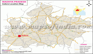
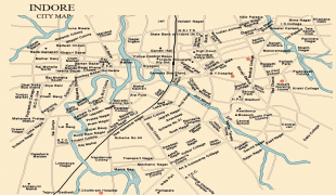
Indore is the largest and most populous city in the Indian state of Madhya Pradesh. It serves as the headquarters of both Indore District and Indore Division. It is also considered as an education hub of the state and is the only city to encompass campuses of both the Indian Institute of Technology and the Indian Institute of Management. Located on the southern edge of Malwa Plateau, at an average altitude of 553 meters above sea level, it has the highest elevation among major cities of Central India. The city is 190 km west of the state capital of Bhopal. Indore had a census-estimated 2011 population of 1,994,397 (municipal corporation) and 3,570,295 (urban agglomeration). The city is distributed over a land area of just 530 km2, making Indore the most densely populated major city in the central province. Indore is the cleanest city in India according to Swachh Survekshan Report 2022 sixth time in a row, conducted by MoHUA the world's largest urban sanitation and cleanliness survey.
Indore traces its roots to its 16th-century founding as a trading hub between the Deccan and Delhi. The city and its surroundings came under Maratha Empire on 18 May 1724 after Peshwa Baji Rao I assumed the full control of Malwa. During the days of the British Raj, Indore State was a 19 Gun Salute (21 locally) princely state (a rare high rank) ruled by the Maratha Holkar dynasty, until they acceded to the Union of India. Indore served as the capital of the Madhya Bharat from 1950 until 1956.
Indore's financial district, based in central Indore, functions as the financial capital of Madhya Pradesh and is home to the Madhya Pradesh Stock Exchange.
Indore has been selected as one of the 100 Indian cities to be developed as a smart city under the Smart Cities Mission. It also qualified the first round of Smart Cities Mission and was selected as one of the first twenty cities to be developed as Smart Cities. Indore has been part of Swachh Survekshan since its inception and had ranked 25th in 2016. It has been ranked as India's cleanest city six years in a row as per the Swachh Survekshan for the years 2017, 2018, 2019, 2020, 2021 and 2022. Meanwhile, Indore has also been declared as India's first 'water plus' city under the Swachh Survekshan 2021. Indore became the only Indian city to be selected for International Clean Air Catalyst Programme. The project with cooperation of Indore Municipal Corporation and Madhya Pradesh Pollution Control Board, will be operated for a period of five years to purify the air in the city.
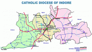
Gupta inscriptions name Indore as 'Indrapura'. It is believed that the city is named after its Indreshwar Mahadev Temple, where Indra is the presiding deity. It is believed that Indra himself did Tapasya (meditation) in this place and led sage Swami Indrapuri to establish the temple. Later, Tukoji Rao Holkar who belonged to the Holkar clan of the Marathas and was the feudatory of Indore, renovated the temple.
Indore traces its roots to its 16th-century founding as a trading hub between the Deccan and Delhi. The city and its surroundings came under Maratha Empire on 18 May 1724 after Peshwa Baji Rao I assumed the full control of Malwa. During the days of the British Raj, Indore State was a 19 Gun Salute (21 locally) princely state (a rare high rank) ruled by the Maratha Holkar dynasty, until they acceded to the Union of India. Indore served as the capital of the Madhya Bharat from 1950 until 1956.
Indore's financial district, based in central Indore, functions as the financial capital of Madhya Pradesh and is home to the Madhya Pradesh Stock Exchange.
Indore has been selected as one of the 100 Indian cities to be developed as a smart city under the Smart Cities Mission. It also qualified the first round of Smart Cities Mission and was selected as one of the first twenty cities to be developed as Smart Cities. Indore has been part of Swachh Survekshan since its inception and had ranked 25th in 2016. It has been ranked as India's cleanest city six years in a row as per the Swachh Survekshan for the years 2017, 2018, 2019, 2020, 2021 and 2022. Meanwhile, Indore has also been declared as India's first 'water plus' city under the Swachh Survekshan 2021. Indore became the only Indian city to be selected for International Clean Air Catalyst Programme. The project with cooperation of Indore Municipal Corporation and Madhya Pradesh Pollution Control Board, will be operated for a period of five years to purify the air in the city.
Gupta inscriptions name Indore as 'Indrapura'. It is believed that the city is named after its Indreshwar Mahadev Temple, where Indra is the presiding deity. It is believed that Indra himself did Tapasya (meditation) in this place and led sage Swami Indrapuri to establish the temple. Later, Tukoji Rao Holkar who belonged to the Holkar clan of the Marathas and was the feudatory of Indore, renovated the temple.
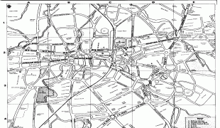
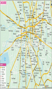
Map - Indore
Map


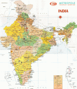


Country - India
 |
 |
| Flag of India | |
Modern humans arrived on the Indian subcontinent from Africa no later than 55,000 years ago. Their long occupation, initially in varying forms of isolation as hunter-gatherers, has made the region highly diverse, second only to Africa in human genetic diversity. Settled life emerged on the subcontinent in the western margins of the Indus river basin 9,000 years ago, evolving gradually into the Indus Valley Civilisation of the third millennium BCE. By, an archaic form of Sanskrit, an Indo-European language, had diffused into India from the northwest. (a) (b) (c), "In Punjab, a dry region with grasslands watered by five rivers (hence ‘panch’ and ‘ab’) draining the western Himalayas, one prehistoric culture left no material remains, but some of its ritual texts were preserved orally over the millennia. The culture is called Aryan, and evidence in its texts indicates that it spread slowly south-east, following the course of the Yamuna and Ganga Rivers. Its elite called itself Arya (pure) and distinguished themselves sharply from others. Aryans led kin groups organized as nomadic horse-herding tribes. Their ritual texts are called Vedas, composed in Sanskrit. Vedic Sanskrit is recorded only in hymns that were part of Vedic rituals to Aryan gods. To be Aryan apparently meant to belong to the elite among pastoral tribes. Texts that record Aryan culture are not precisely datable, but they seem to begin around 1200 BCE with four collections of Vedic hymns (Rg, Sama, Yajur, and Artharva)."
Currency / Language
| ISO | Currency | Symbol | Significant figures |
|---|---|---|---|
| INR | Indian rupee | ₹ | 2 |
| ISO | Language |
|---|---|
| AS | Assamese language |
| BN | Bengali language |
| BH | Bihari languages |
| EN | English language |
| GU | Gujarati language |
| HI | Hindi |
| KN | Kannada language |
| ML | Malayalam language |
| MR | Marathi language |
| OR | Oriya language |
| PA | Panjabi language |
| TA | Tamil language |
| TE | Telugu language |
| UR | Urdu |